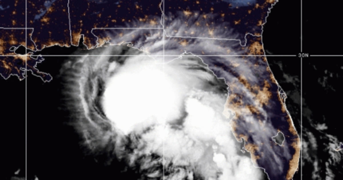
Dauphin Island, Alabama — As the time to prepare for Hurricane Sally runs out, the storm’s threat is coming into focus. Forecasters are expecting a storm surge of up to 11 feet for parts of the Gulf Coast and up to 16 inches of rainfall. Alabama, Mississippi and Louisiana have all declared a state of emergency.
More than 17 million people are in the path of the Category 2 hurricane. Hundreds of miles of coastline are under storm watches and warnings. There’s a possibility that Sally will turn into a major Category 3 storm with maximum sustained winds of at least 111 mph before it makes landfall Tuesday afternoon.
Andrew Gilich, the mayor of Biloxi, Mississippi, is concerned about the storm surge. “We’re hearing, of course, it’s changing almost every hour, 7 to 11 feet of storm surge,” he said. “That’s what kills people.”
Luis A. Sanabria puts plywood over the windows of a business in the historic French Quarter on Monday, September 14, 2020, in New Orleans.
Joe Raedle / Getty
Earlier forecasts showed the hurricane making a direct hit on New Orleans. Sally is tracking east, but officials still aren’t taking any chances. CBS News was there as flood gates closed, and the city braces for a potential storm surge.
The system was put into place after Hurricane Katrina. The idea is that the metal doors will close and minimize the water going into the city.
Even before intensifying, Sally had already dumped close to a foot of rain which led to flooding in parts of Florida, like the Keys.
The National Hurricane Center is predicting the storm surge will be deadly and officials are urging people to get out.
The hurricane center said in its latest advisory that Sally’s outer rain bands are moving onshore in the Florida panhandle. The hurricane center said Sally is about 100 miles east of the mouth of the Mississippi River and 135 miles southeast of Biloxi, moving west-northwest at 5 mph.
When will Hurricane Sally make landfall?
01:19
