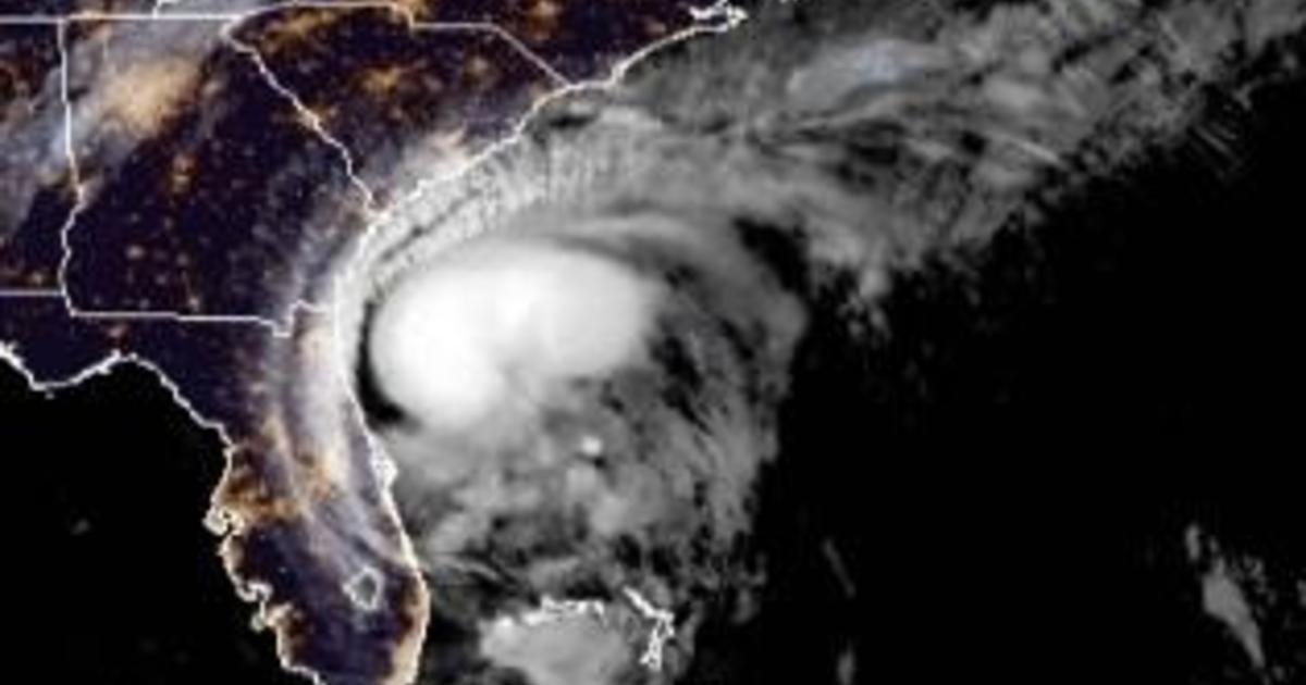
Isaias was forecast to return to hurricane strength Monday before making landfall in the Carolinas, where coastal residents were warned to brace for flooding rains and storm surge. The U.S. National Hurricane Center issued a hurricane warning from South Santee River, South Carolina, to Surf City, North Carolina.
Isaias was still a tropical storm at 11 a.m. EDT with maximum sustained winds of 70 mph, but it was expected to strengthen into a Category 1 hurricane later Monday, with winds of 74 mph or more.
Tropical Storm #Isaias Advisory 26: Isaias Forecast to Make Landfall Tonight as a Hurricane. Expected to Bring Strong Winds and Heavy Rainfall From the Eastern Carolinas to the Mid-Atlantic Coast Tonight and Tuesday. https://t.co/VqHn0u1vgc
— National Hurricane Center (@NHC_Atlantic) August 3, 2020
“We are forecasting it to become a hurricane before it reaches the coast this evening,” senior hurricane specialist Daniel Brown said. “It’s forecast to produce a dangerous storm surge, of 3 to 5 feet in portions of North and South Carolina.”
Isaias – pronounced ees-ah-EE-ahs – could bring heavy rains, too – up to 8 inches in spots as it moves up the coast, Brown said -and “all those rains could produce flash flooding across portions of eastern Carolinas and mid-Atlantic, and even in the northeast U.S.”
As #GOESEast watched #TropicalStormIsaias yesterday evening, we can see all the #lightning the storm produced thanks to the satellite's Geostationary Lightning Mapper (#GLM). This imagery is also via visible band 2, which has the finest resolution of all ABI bands. pic.twitter.com/WIEWouaXpC
— NOAA Satellites (@NOAASatellites) August 3, 2020
Isaias killed two people in the Caribbean and roughed up the Bahamas but remained at sea as it brushed past Florida over the weekend, providing some welcome relief to emergency managers who had to accommodate mask-wearing evacuees in storm shelters.
In Myrtle Beach, South Carolina, people walking dogs strolled the sand Monday morning under overcast skies while children played in surf that gently lapped the shore.
“We’re from Michigan, so we get snow and go through it all,” Aliyah Owens, who arrived in Myrtle Beach for a summer vacation Sunday, told WTBW-TV. “A little water isn’t going to hurt.”
CBS affiliate WCSC-TV reports tropical storm warnings continue up and down the South Carolina coast as far inland as Orangeburg and Kingstree. A storm surge warning is in effect for two to four feet above ground level especially along the coast because of the high tide.
11 AM UPDATE: Isaias remains a tropical storm, but is still expected to strengthen to a cat 1 hurricane today. The storm will brush the coastline tonight and should make landfall north- closer to Georgetown & Horry Counties. Conditions will continue to deteriorate this afternoon. pic.twitter.com/yw49btWwTR
— Joey Sovine Live 5 (@JoeySovine) August 3, 2020
The storm remained about 220 miles to the south-southwest of Myrtle Beach at 11 a.m., though conditions were expected to worsen as Isaias picked up speech and marched northward.
At the Caribbean Resort & Villas in Myrtle Beach, grounds manager Jeremy Philo was out before sunrise Monday looking for loose objects that might be picked up and tossed like missiles by the storm’s winds. He tied down lounge chairs by the pool and removed hanging baskets and patio furniture from hotel balconies.
“Anything that can move we tie down or bring inside,” Philo told The Sun News of Myrtle Beach.
In North Carolina, the state Department of Transportation tweeted Monday morning that its ferry operators were wrapping up evacuations of tourists and residents from Ocracoke Island. The ferry division tweeted Sunday that its vessels had carried 3,335 people and 1,580 vehicles off of Ocracoke, which is reachable only by plane or boat.
Officials began evacuations on North Carolina’s Outer Banks over the weekend, taking no chances after the area took a beating less than a year ago from Hurricane Dorian.
At 11 a.m. Monday, the center of Isaias was passing about 90 miles to the east-southeast of Brunswick, Georgia, where state officials closed a towering suspension bridge out of concern that wind gusts of tropical-storm force could endanger motorists.
Officials across the southern Atlantic U.S. coast kept a close eye on the storm while dealing with surging cases of the coronavirus. Over the weekend, Isaias brought heavy rain and flooding to Florida even after weakening from a hurricane to tropical storm. Its most damaging winds remained offshore.
Authorities closed Florida beaches, parks and virus testing sites, lashing signs to palm trees so they wouldn’t blow away. Officials also adapted their shelter policies to the pandemic, providing spaces where people could stay safely apart from each other to prevent the spread of the virus.
In Palm Beach County, about 150 people were in shelters, and they were wearing masks, said emergency management spokeswoman Lisa De La Rionda. The county has a voluntary evacuation order for those living in mobile or manufactured homes, or those who feel their home can’t withstand winds.
Isaias caused destruction and two deaths as it uprooted trees, destroyed crops and homes and caused widespread flooding and small landslides in the Dominican Republic and Puerto Rico. One man died in the Dominican Republic. In Puerto Rico, the National Guard rescued at least 35 people from floods that swept away one woman, whose body was recovered Saturday.
Isaias then snapped trees and knocked out power as it blew through the Bahamas on Saturday. Officials in the Bahamas opened shelters for people in Abaco island to help those who have been living in temporary structures since Dorian devastated the area, killing at least 70 people in September 2019.
