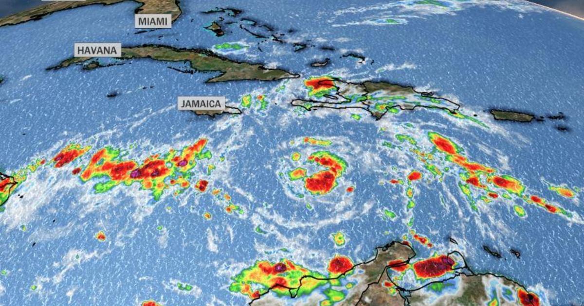
Tropical Storm Eta formed in the central Caribbean on Saturday, becoming the 28th named storm of the 2020 Atlantic hurricane season. The 2020 season has now tied the record for the most named storms in a season, previously set in 2005.
While the number of storms in 2005 was also 28, this is the first time the name Eta will ever be used. In 2005, there were only 27 named storms, with one unnamed subtropical storm being added to the tally in a post-season reanalysis by the National Hurricane Center.
2020 has been a remarkable hurricane season by many measures. This season also holds the record for the most tropical systems to make landfall in the U.S., with 11, and ties the record for most landfalling hurricanes at six.
#Zeta becomes the 11th named storm and 6th hurricane to make U.S. landfall in 2020. Both are seasonal records (the 6 hurricane landfalls ties with 1985 and 1886). Louisiana is the first state with five named storm landfalls in a season.
2020 U.S. TC damage costs already >$30B. pic.twitter.com/gOrzIQs837
— Steve Bowen (@SteveBowenWx) October 28, 2020
Unfortunately, the overactive season shows no signs of stopping, at least through the middle of November, because the large-scale pattern across the Atlantic Basin indicates at least two more weeks of favorable conditions for tropical systems to form.
On Saturday night, Eta was located about 600 miles east of the border of Nicaragua and Honduras, moving west at 15 mph. The system has maximum sustained winds of 40 mph and is expected to intensify to a hurricane by Monday.
As Eta approaches the border of Nicaragua and Honduras on Monday and Tuesday, steering patterns will break down, and the system will slow down considerably. While a landfall does look likely on Tuesday just south of the border, what happens next is still not clear.
The predicted path of Tropical Storm Eta as of Saturday, October 31, 2020.
CBS News
With weak and uncertain steering, the storm will likely meander near the Central American coast for a few days, dumping torrential rains on the region. However, some computer models show that it may eventually move back northeast into the Caribbean again. If that happens, there is some chance the system may be swept northward in the longer range — next weekend into the week after.
Although the chances remain rather minimal at this time, it is not out of the question the U.S. may have to prepare for yet another tropical system landfall. While rare, tropical systems can impact the U.S. in November. It mainly happens in Florida, as fall cold fronts steer western Caribbean storms northeastward.
In total, Florida has been hit by eight tropical systems during November, two of which were hurricanes. In 1985, Hurricane Kate hit the Florida Panhandle as a Category 2, and in 1935, the Yankee Hurricane hit Miami.
If Invest #96L should reach hurricane intensity, it would have plenty of company, historically. November hurricanes are not that rare, especially in the western Caribbean.https://t.co/oCGseBeL3o
#Eta #HurricaneSeason pic.twitter.com/MiWdPS4HeN— Brian McNoldy (@BMcNoldy) October 30, 2020
2020’s extra-warm ocean temperatures make it all the more likely that tropical systems may continue to form even after the official end of hurricane season on November 30. Since the 1700s, there have been 27 tropical systems that we know of which formed in the month of December.
Currently, almost the entire Atlantic Basin has above normal sea surface temperatures.
Surface temperature of the Atlantic Ocean.
National Hurricane Center
Above normal ocean temperatures are part of a long-term trend of warming waters since the early 1900s. In the Tropical Atlantic, sea surface temperatures have risen by 2 degrees Fahrenheit since that time as a result of human-caused climate change.
Rising temperatures of the Atlantic Ocean.
Climate Central
This matters because tropical systems, which need ocean temperatures of 80 degrees or higher to form, are encountering this threshold more often, in more geographical areas and for a longer part of the year. That means there is now a greater chance of active seasons with tropical systems forming outside the traditional geographical boundaries and outside of the traditional seasonal timing as well.
